Rain, Sleet Will Make Icy Mess and Difficult Travel for Monday| 03:29PM / Sunday, December 29, 2019 | |
A messy mix of rain, sleet and snow is about to fall over the Berkshires, covering the last days of 2019 in an icy sheet that may make travel "impossible," according to the National Weather Service.
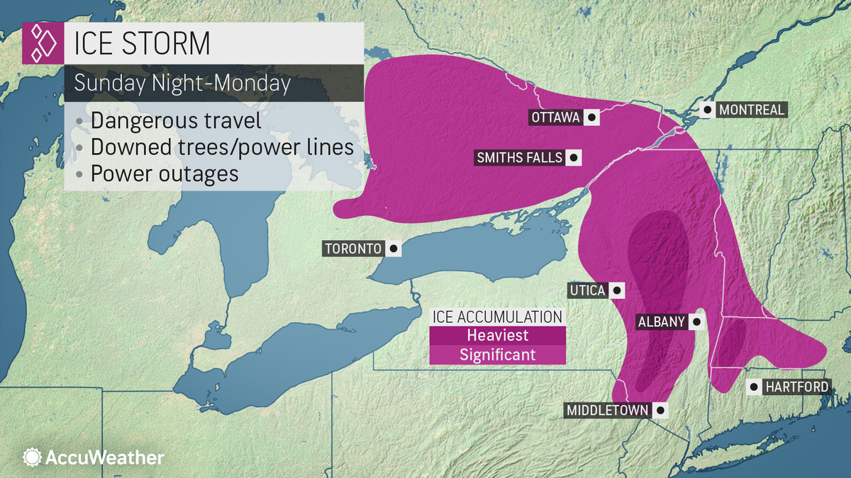
The NWS office in Albany, N.Y., has posted an ice storm warning for the Berkshires and northern Connecticut from 5 p.m. Sunday into 7 a.m. Tuesday.
Significant icing is expected from freezing rain, especially after midnight Sunday night. This icing may cause power outages from tree damage and travel "could be impossible. The hazardous conditions will impact the Monday morning and evening commutes," according to the NWS.
The freezing rain could mix with some sleet late Monday into Monday evening.
A winter storm warning is also in effect from 5 p.m. Sunday and into Tuesday at 1 p.m. for eastern New York and Southern Vermont. Heavy mixed precipitation expected. The storm could bring total snow and sleet accumulations of 1 to 4 inches and ice accumulations of a quarter to a half of an inch. Winds may gust as high as 35 mph.
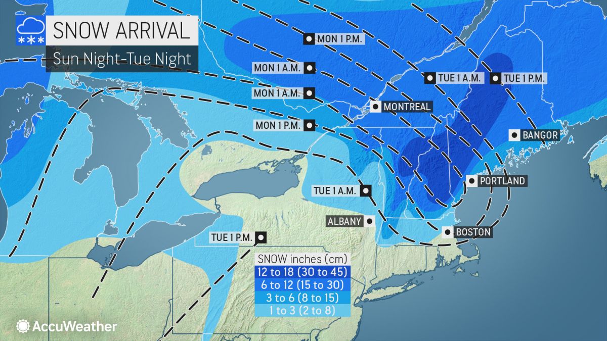
Snow, sleet and ice accumulations will vary from location to location because of the variations in different precipitation types and the times they arrive over the region.
Accuweather says a warm wedge of air below New England means springlike temperatures for the mid-Atlantic coast. But it means a range of precipitation when hits the cold air hovering over Upstate New York and New England.
"Should the warm air race in a few thousand feet above the ground, then little snow, on the order of a few inches or less, will fall," AccuWeather Senior Meteorologist Brett Anderson said. "Should the cold air resist this warm wedge, then parts of central and northern New England could be buried under a foot of snow or more."
The good news is that January is expected to be warmer than normal across the Northeast with temperatures rising in time for the ball drop on New Year's Eve.
| 
 MEMBER SIGN IN